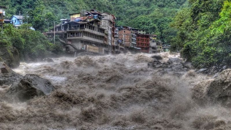
ME: Latin America is blessed with national resources, with great culture – but it is in an area highly exposed to natural hazards, so it is important to look at disaster and climate change risk.
To give you one example, we have been working with the region at the IDB on how to look at risk at the project level. This is the work of a big team, several years, and I’m happy to say that at Cop we are launching a full methodology. We have worked very closely with sectors as well – we started with energy, with transport, with water and sanitation, and we are moving to education, health, urban development, and irrigation, this year.
I think a key thing first is to see how we conceptualise risk.
Risk is the intersection of the hazard. That could be; the temperature increase. Do you have a volcano close by? Are you exposed to hurricanes etc? We have a screening of those hazard layers at the IDB, and we include climate change scenarios on that. But it is very important to also to look at the exposure and the vulnerability, to look at risk.
What do we mean by that? What are the assets that are exposed? What material are they made of? It is that intersection between the hazard, the exposure, and the vulnerability, that gets us to risk.
And how can we look at that? At the IDB we have been thinking about this methodology that has three steps. There is a screening phase, there’s a qualitative phase, and then there’s a quantitative phase. But that is divided into five steps. So, let me explain a little about that.
As we were looking at risk, we needed to look at the hazards, the exposure, and the vulnerability, so the screening is made of the layers of the hazard, from temperature change, to hurricanes, to flood hazard, and these hydrometeorological hazard layers include climate change consideration.
That we combined with the criticality and vulnerability aspects of the project. Is it a project that is financing an irrigation channel? Could this have big consequences in the community for water extraction? Or could the channel itself, if there’s an event and the channel has problems, could that have a big impact on the community or the project itself.
Same in that you can look at the dimensions of the water and sanitation intervention, or the electricity intervention. For example, if it’s a dam that provides electricity to a big part of the community – that by itself might be a high-risk project, regardless of where it is, just because the project is too big to fail.
So, after that screening, projects will be classified as high, medium, or low. And then to guide projects into what is needed, after that there is a qualitative phase, that’s basically a simplified assessment and then a more in-depth assessment.
Why is the first a simplified assessment? – because the first thing is to see what information is already out there. What design codes have been used? Is there already a land–use plan or urban plan in the locality? What design parameters were used? Maybe the project has already incorporated a lot of this. So, we don’t want to create a layer of news stories just to create news stories. We want to gather all the information that’s already there.
If that’s not enough, we jump to a more in-depth qualitative assessment that might include a field mission, meetings with experts, following the Delphi Method, or following modes of failure analysis. And that is very important because it helps us think what the problem could be.
And jumping to the quantitative analysis just in the areas where it’s necessary, because the last step would be a quantitative analysis, that is useful because it gets you a quantitative measure of losses. We are very interested in losses – of course, we want to avoid the human cost that a disaster can have, and it helps us to monetise the losses.
Why is this important? Because it helps us make decisions. Risk is not easy for it be zero. There is generally some risk and what we need is to manage it.
But to manage risk, we first need to understand it. That is the most important thing about a risk assessment.
It allows us to understand risk, and then we can have measures incorporated into the project designed to reduce that risk. There’s always going to be a residual or extra risk that might need to be financed. Then also early warning systems etc to be ready in case there’s an event. So, we want to go through the full risk cycle of understanding risk, of reducing the risk, of being ready to respond in case there’s an event, and financing the risk.
Also, if I can really quickly mention, that this is very important to be done in conjunction with the project counterparts and the countries.
In the end it’s a combination, it’s a decision with the government, with the local beneficiaries, that the project would serve.
Read the report of IDB’s Disaster and Climate Change Risk Assessment Methodology here.
This post was sponsored by the Inter-American Development Bank. See our editorial guidelines for what this means.